Study of Hydrodynamic Patterns of Tanjung Pasir Banten Waters to Support the NCICD Sea Wall Development Plan
DOI:
https://doi.org/10.25299/jgeet.2023.8.1.10801Keywords:
Sea Wall, Numerical Modelling, Tidal Condition, Current ConditionAbstract
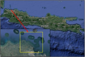
Numerical modeling of hydrodynamics (HD) around the Tanjung Pasir Waters was carried out using MIKE 21 HD Flexible Mesh software to get the current velocity pattern conditions during the west and east monsoons. This activity is to support the NCICD sea wall construction plan. In addition, the results that will be obtained in this modeling are the conditions of the speed and direction of the current in various tidal conditions during spring and neap. The data used in this modeling include wind speed and direction, wave height, wave period, and wave direction. Based on the research that has been done, the validation value of Naotide tidal data on tidal field data is 93.8 %. HD MIKE 21 modeling results on field data have a validation value of 93.4 %. Extract points 4 and 5 which are the northernmost, have the highest current velocity values compared to the other points. In addition, when heading to the high tide phase, both spring and neap conditions, the current velocity value has the highest value.
Downloads
References
Aprilia, E., 2017. 3-Dimensional Hydrodynamic Modeling of Pre and Post-Reclamation Sedimentation Distribution Patterns in Jakarta Bay. Bachelor Thesis. Department of Geomatics Engineering, Faculty of Civil Engineering and Planning, Sepuluh Nopember Institute of Technology.
Aprilia, E., Pratomo, D.G., 2017. 3-Dimensional Hydrodynamic Modeling of Pre- and Post-Reclamation Sedimentation Distribution Patterns in Jakarta Bay Reklamasi Teluk Jakarta. Jurnal Teknik ITS 6, 2337–3520.
BIG, 2021. Seamless Digital Elevation Model (DEM) and BATNAS (Batimetri Nasional) of Tanjung Pasir Waters. Batnas.
BTIPDP, 2021. Bathymetry and Tidal Survey Report of Cisadane Estuary. Agency for the Assessment and Application of Technology. Jogjakarta.
Gaol, A.S.L., Diansyah, G., Purwiyanto, A.I.S., 2017. Analysis of Seawater Quality in the Southern Bangka Strait. Maspari Journal 9, 9–16.
Google Earth, 2022. Google Earth : Maps of Tanjung Pasir Waters, Banten. Google Earth.
Khoirunnisa, H., Wibowo, M., Gumbira, G., Hendriyono, W., Karima, S., 2021a. Numerical Modeling of the Effects of Reclamation and Proposed Infrastructures on Thermal Dispersion of Power Plant Wastewater at PLTGU Muara Karang, Jakarta Bay, in: IOP Conference Series: Earth and Environmental Science. IOP Publishing Ltd.
Khoirunnisa, H., Wibowo, M., Hendriyono, W., Wardani, K.S., 2021b. Hydrodynamic And Boussinesq Wave Modeling for The N219 Amphibious Aircraft Seaplane Dock Development Plan in Panjang Island. Majalah Ilmiah Pengkajian Industri 15, 87–89.
Kumajas, M., Kumaat, J.C., Moninhkey, A., 2007. Study on Hydro-Oceanographic and Bathymetry conditions of Bajo–Popareng Beach, South Minahasa Regency. Jurnal Geografi dan Pembangunan Wilayah. Manado State University III.
Lukisworo, B., 2011. How to Test Total Suspended Solids (TSS) Gravimetrically, in: Cara Uji Padatan Tersuspensi Total (Total Suspended Solid, TSS) Secara Gravimetri.
Matsumoto, K., 2022. Tidal Prediction System Nao99b. (Accessed Jan 2022). NAO.99b Tidal Prediction System.
Matsumoto, K., Takanezawa, T., Ooe, M., 2000. Ocean Tide Models Developed by Assimilating Topex/Poseidon Altimeter Data into Hydrodynamical Model:A Global Model and a Regional Model around Japan. J Oceanogr 56, 567–581.
Mike 21 DHI, 2019. MIKE 21 Flow Model Hydrodynamic Module User Guide. DHI.
Mike 21 DHI, 2017. MIKE 21 Spectral Waves FM Spectral Wave Module User Guide. DHI.
MIke 21 DHI, 2017. Mike 21 Hydrodynamic Module. DHI.
Miwa, H.;, Ikeno, H., 2008. A Setup Method of Tide Level Variations at Open Boundary in Estuaries for Numerical Tidal Flow Analysis, in: ICHE 2008. Proceedings of the 8th International Conference on Hydro-Science and Engineering.
Molteni, F., Buizza, R., Palmer, T.N., Petroliagis, T., 1996. The ECMWF Ensemble Prediction System: Methodology and Validation. Quarterly Journal of The Royal Meteorologial Society 122 (529), 73–119.
Mukhtasor, 2006. Coastal and Marine Pollution. PT Pradnya Paramita Jalan Bunga 8-8A. Jakarta., Jakarta.
Nugraha, T., 2022. Hydrodynamic Model and Cohesive Sediment Transport in Jakarta Bay Coastal System. Doctoral Dissertation. Institut Pertanian Bogor, Bogor.
Padman, L., Erofeeva, S., 2005. Tide Model Driver (TMD) Manual, in: Tide Model Driver (TMD Manual). Earth and Space Research.
Prihantono, J., Fajrianto, I.A., Kurniadi, Y.N., 2018. Hydrodynamic Modeling and Sediment Transport in Coastal Waters Around Tanjung Pontang, Serang-Banten Regency. Jurnal Kelautan Nasional 1.
Saputra, R.A., 2018. Modeling of post-reclamation sedimentation and master plan in Jakarta Bay using Mike21. Doctoral dissertation. Faculty of Science and Technology State Islamic University Sunan Ampel Surabaya.
Sato, T., Hanada, H., Matsumoto, K., Takanezawa, T., Ooe, M.,2001. A Program for the Computation of Oceanic Tidal Loading Effects: “GOTIC” Study of Earth Rotation, Preceission, and Nutation View project Lunar physical libration and navigation View project GOTIC2: A Program for Computation of Oceanic Tidal Loading Effect, Journal of the Geodetic Society of Japan.
Suhana, M.P., 2015. Hydro-Oceanographic Studies for Detection of Coastal Dynamics Processes (Abrasion and Sedimentation). Postgraduate Marine Science, Bogor Agricultural University.
Triatmodjo, B., 2012. Perencanaan Bangunan Pantai, 3rd Edition 2014. ed, Beta Offset. Yogyakarta.
Triatmodjo, B., 1999. Teknik Pantai, 8th Edition 2016. ed. Beta Offset, Yogyakarta.
Wibowo, M., Khoirunnisa, H., Wardhani, K.S., Wijayanti, R., 2022a. Pemodelan Pola Sedimentasi di Muara Cisadane untuk Mendukung Pengembangan Terpadu Pesisir Ibukota Negara. Jurnal Kelautan Tropis 25, 179–190.
Wibowo, M., Khoirunnisa, H., Wardhani, K.S., Wijayanti, R., 2022b. Modeling of Sedimentation Patterns in the Cisadane Estuary to Support the Integrated Development of the National Capital Coast. Jurnal Kelautan Tropis 25, 179–190.
Wibowo, Y.A., 2012. Dinamika Pantai (Abrasi & Sedimentasi). Faculty of Engineering and Marine Sciences. Hang Tuah University, Surabaya.
Wiguna, E.A., Wibowo, M., Rachman, R.A., Aziz, H., Nugroho, S., 2020. Hydrooceanographic Conditions of the Jelitik River Estuary, Sungailiat, Bangka, Bangka Belitung Province. Buletin Oseanografi Marina 9, 9–18.
Yona, D., Sartimbul, A., Iranawati, F., Sambah, A.B., Hidayati, N., Harlyan, L.I., Sari, S.H.J., Fuad, M.A.Z., Rahman, M.A., 2017. Fundamental Oseanografi. UB Press – Universitas Brawijaya University, Malang.
Downloads
Published
Issue
Section
License
Copyright @2019. This is an open-access article distributed under the terms of the Creative Commons Attribution-ShareAlike 4.0 International License which permits unrestricted use, distribution, and reproduction in any medium. Copyrights of all materials published in JGEET are freely available without charge to users or / institution. Users are allowed to read, download, copy, distribute, search, or link to full-text articles in this journal without asking by giving appropriate credit, provide a link to the license, and indicate if changes were made. All of the remix, transform, or build upon the material must distribute the contributions under the same license as the original.